Charyn Canyon Guide: Valley of Castles & Access
Reported from the ground: Tugelbay Konabayev is a Kazakh native (born in Aktobe) who has lived 7 years in Almaty and 4 in Astana. About the author.
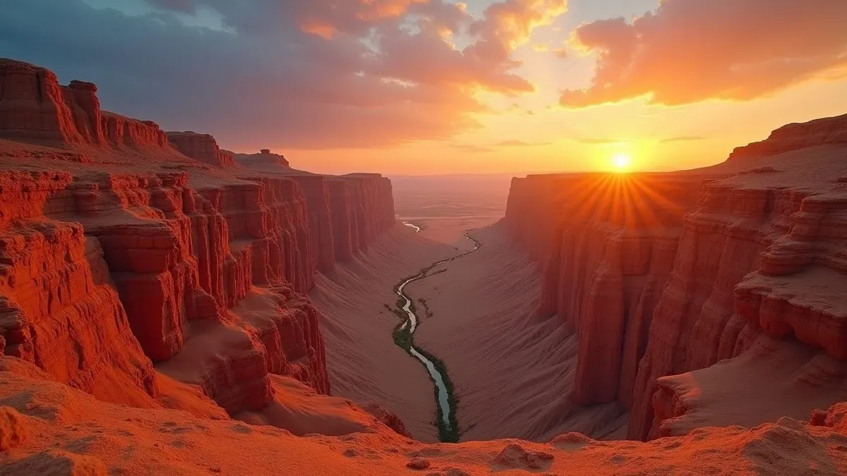
In this article11 sections
I have been to Charyn Canyon six times, and the red sandstone formations still stop me mid-sentence every time I round the last hill before the viewpoint. The landscape contains layered sedimentary formations shaped by erosion, but this review did not capture a direct geological source for one exact canyon age, length, or wall height. Those headline measurements should therefore be treated as estimates rather than route-planning facts. See our guide to Kazakhstan’s mountains and ranges for other landscapes.
The best-known sector is the Valley of Castles, a dry side canyon inside Charyn State National Nature Park. It is a popular day trip from Almaty, but exact drive time, entrance procedure, road condition and park tariff require a current check with the park or operator.
Getting There from Almaty
| Option | Time | Cost | Best for |
|---|---|---|---|
| Organized tour | Full-day plan | Confirm current quote and inclusions | First visit without a car |
| Rental car | Full-day plan | Confirm current rental and fuel terms | Flexible schedule |
| Shared transport | Limited availability | Confirm departure and return directly | Experienced planners |
| Private driver | Full-day plan | Obtain a written current quote | Flexible return |
Road surface, closures, traffic, entrance routing, and travel time can change. Check the current route and park status before departure, preserve daylight for the return, and choose a vehicle appropriate for the reported conditions. An early start can reduce heat exposure, but no fixed departure guarantees an arrival time or crowd level.
Valley of Castles: The Main Attraction
The Valley of Castles is the park’s best-known visitor sector. Treat old visitor-share estimates as promotional context, not a current measured statistic:
- Route length: use the current park or operator route map
- Depth and width: vary by sector; do not plan from unsourced headline measurements
- Trail difficulty: Easy to moderate. A well-worn path with some rocky sections.
- Time needed: depends on heat, surface conditions, stops, and the chosen turnaround point
What you see: Layered red and orange sedimentary formations shaped by erosion. This guide does not retain an exact formation age or universal dimensions without a directly captured geological source. Light and weather change the appearance throughout the day.
Facilities and river conditions at the canyon bottom change. Do not assume swimming, camping, food, or lodging is available or permitted; verify current facilities and rules before departure.
Beyond the Valley of Castles
Most visitors only see the main valley. According to park rangers I have spoken with, the canyon has several other sections worth exploring:
Temirlik Canyon (3 km east). Home to an ash tree grove (Fraxinus sogdiana) that according to the Kazakhstan Botanical Institute has survived since the Ice Age. National Geographic’s coverage of Central Asian canyon landscapes highlights relict tree groves like this as rare Ice Age survivors in otherwise arid terrain. These trees are relicts - the same species that covered Central Asia before the last glaciation.
Moon Canyon. Lighter-colored formations with a different geological character. Treat it as a separate route decision and verify current access, driving, walking, and turnaround conditions.
Black Canyon. Dark basalt formations, more remote and less accessible. Best with a guide or GPS.
Charyn vs. Grand Canyon
Visitors always compare them. Here are the real numbers:
| Feature | Charyn Canyon | Grand Canyon (Arizona) |
|---|---|---|
| Total length | 154 km | 446 km |
| Maximum depth | 300 m | 1,800 m |
| Rock age | 12 million years | 5-6 million years |
| Visitor volume | No current count retained | Check current NPS data |
| Entrance fee | Check current park tariff | Check current NPS fee |
| Weekday crowds | No current count retained | Check current NPS data |
The two places differ greatly in scale, geology, climate, visitor infrastructure, and management. The comparison is a visual shorthand, not a scientific equivalence or a reason to repeat undated visitor counts. Charyn’s practical advantage is that it can be planned as a full-day trip from Almaty, subject to current road and park conditions.
Best Time to Visit
| Season | Temperature at canyon | Conditions | Rating |
|---|---|---|---|
| April-May | 15-25°C | Wildflowers on steppe, green landscape, best light | Best |
| June-August | 30-40°C | Scorching at midday, go at dawn or dusk | Good if early |
| September-October | 10-20°C | Golden steppe, clear skies, perfect hiking | Best |
| November-March | -10 to 5°C | Snow possible, fewer visitors, dramatic light | Possible but harsh |
According to my own visits: early October is the perfect time. The steppe turns gold, the canyon walls glow red, the air is cool enough for comfortable hiking, and you might have the entire Valley of Castles to yourself on a Tuesday.
What to Bring
Based on six visits:
- Water: 2+ liters per person. No reliable water on the trail.
- Shoes: Closed-toe with grip. The rocky path will destroy flip-flops and your feet.
- Sun protection: Hat, sunscreen, sunglasses. No shade in the canyon.
- Warm layer: Canyon floor can be 10°C cooler than the rim. Wind funnels through.
- Snacks: The cafe at the canyon bottom exists but selection is limited.
- Camera: Obviously. Extra battery - cold temperatures drain batteries faster.
- Cash: Check current park tariff entrance fee. The cafe may not take cards.
- Offline maps: Cell service is unreliable in the canyon.
Practical Details
- Entrance fee: verify the current tariff, payment method, and vehicle rules
- Hours and access: verify current opening procedure, sector access, road conditions, and closures
- Camping: use only currently authorized sites after confirming permission, fire restrictions, facilities, and overnight rules
- Food and lodging: verify whether any licensed facility is operating and what it provides; carry essentials rather than depending on it.
- Toilet: Basic facilities at the parking area. Nothing on the trail.
Combine With Other Almaty Trips
Charyn is often combined with nearby destinations:
- Kolsai Lakes (3 alpine lakes, ~80 km further east). Requires overnight.
- Kaindy Lake (submerged forest lake). It needs its own current road, park, and return-time plan.
- Big Almaty Lake - different direction, separate day trip.
- Medeu and Shymbulak - mountains south of Almaty, separate day.
- Turgen Waterfall - on the route to Charyn, easy add-on.
According to Almaty day trip guides, Charyn + Kolsai is the classic 2-day combo if you have the time.
The Geology Behind the Formations
Charyn Canyon exists because of a collision between tectonic plates that happened roughly 12 million years ago, followed by millions of years of river erosion that carved the gorge you walk through today.
According to geological surveys by the Kazakh Institute of Geological Sciences, the canyon walls consist of Neogene sedimentary layers deposited between 23 and 5 million years ago. These layers include alternating sandstone, siltstone, conglomerate, and clay, each with different hardness and different resistance to erosion. The Charyn River exploited the softer layers, cutting downward and sideways at unequal rates. The result is the asymmetric, jagged profile of the Valley of Castles: columns standing where hard rock resisted, gaps where soft material washed away. The red and orange colors come from iron oxide (rust) in the sandstone. According to Wikipedia’s geology notes on Central Asian basins, the canyon system represents one of the most complete exposed sections of Neogene stratigraphy in Central Asia, studied by geologists from multiple countries.
The Charyn River itself originates in the Kungey Alatau range on the Kazakhstan-Kyrgyzstan border and flows north and west before joining the Ili River, which feeds Lake Balkhash. The canyon section covers roughly 154 km of the river’s total length. During spring snowmelt, the Charyn runs fast and muddy brown. By late summer it shrinks to a shallow, clear stream that visitors wade across at the canyon bottom. The riverbed is worth exploring at any time of year: smooth stones polished by millennia of current, undercut walls, and the sound of water bouncing off 300-meter walls.
Earthquakes have also shaped the canyon. Kazakhstan sits on the northern edge of the Tian Shan seismic zone, and tremors continue to crack and tumble sections of canyon wall to this day. Fresh rock falls are visible in several spots, identifiable by the lighter color of newly exposed stone.
Wildlife and Flora Inside the Canyon
Charyn Canyon harbors a surprising range of life within what looks at first like a barren landscape of rock and dust.
The Sogdian ash grove (Fraxinus sogdiana) in Temirlik Canyon, 3 km east of the Valley of Castles, is the ecological centerpiece of the area. According to the Kazakhstan Botanical Institute, this relict forest contains ash trees whose ancestors survived the last Ice Age in this sheltered valley while the species was wiped out across the rest of Central Asia by glaciation. The grove is estimated to be over 5,000 years old as a continuous ecosystem. Individual trees grow to 15 meters, their roots reaching the water table far below the dry canyon floor. The grove is accessible on foot from the main valley and is genuinely one of the most unusual ecosystems in Central Asia: a green pocket of ancient forest surrounded by red desert canyon.
Animal life in the canyon is concentrated near the river. The Charyn River and its banks host European mink (now critically rare in Kazakhstan), several species of fish, kingfishers, and herons. The canyon walls are home to Eurasian kestrels and Egyptian vultures. According to park rangers, red foxes and badgers are common at dusk and dawn on the canyon rim. Reptiles, including agama lizards and steppe tortoises, are visible on sunny rock surfaces throughout the day.
Wildflowers carpet the canyon rim in April and May, when the surrounding semi-desert steppe is at its greenest. By June the steppe dries to gold, and by August it is brown and bare. The canyon floor, kept cooler and moister by shade and proximity to the river, holds vegetation longer than the rim. Visitors who look carefully will find flowering plants tucked into rock crevices throughout the summer.
Safety, Permits, and Park Logistics
Charyn National Park is well-managed by Kazakhstani standards, but it requires more self-sufficiency than parks in Western Europe or North America.
The bounded July 2026 research did not capture a usable authoritative tariff or access page. Verify the current entrance, tariff, payment method, road status, sector closures, vehicle rules, and ranger instructions through an official Kazakhstan protected-area channel or your licensed operator before departure. Do not rely on a saved fee or assume that every sector is open.
Carry sufficient drinking water, sun protection, layers, navigation, and essential medication without depending on a café, tap, card terminal, or continuous mobile signal. River water, heat, wind, ice, and loose surfaces require conservative decisions. Check the current forecast and turn around early if conditions worsen.
Save Kazakhstan’s official 112 emergency guidance before leaving coverage, but do not treat a phone as a substitute for preparation. Share the route and return plan with someone, keep the group together, and follow any closure or ranger instruction.
Before committing to the descent, identify the turnaround point and reassess the group at the trailhead. Heat tolerance, footwear, water, daylight, and the uphill return matter more than a promotional route time. If the entrance, sector, or facility status cannot be confirmed, choose a shorter plan rather than improvising around barriers. Keep enough food, water, battery, and warm clothing for delays, and never separate from a child or less-experienced walker to save time.
Winter access and conditions require a live check. Snow, ice, wind, road status, daylight, and facility availability can change independently, so do not infer canyon conditions from the Almaty forecast alone.
Frequently Asked Questions
How long does a Charyn Canyon trip from Almaty take?
Plan it as a full-day trip from Almaty, but do not rely on a fixed duration. Current routing, road surface, traffic, park status, stops, and the operator's itinerary determine travel and return times.
Is Charyn Canyon worth visiting?
It is rewarding for its layered red formations and exposed canyon walk. Exact formation dimensions and ages vary by sector and require a direct geological source; visitor counts and attraction rankings should not be treated as current without a dated source.
What is the best time to visit Charyn Canyon?
According to local conditions, April-May and September-October offer the best temperatures and light. Summer is very hot at midday but works if you arrive early. October is ideal for photography as the steppe turns gold and canyon walls glow red in softer sunlight.
Can you camp at Charyn Canyon?
Do not assume camping or an eco-lodge is currently available, and never use an informal site without permission. Verify current hours, designated facilities, sector access, fire restrictions, and overnight rules through an official protected-area channel or licensed operator.
How much does it cost to visit Charyn Canyon?
A national-park charge may apply, but tariffs and payment arrangements change. Verify the official park tariff and obtain current written tour or rental quotes before departure.
Is Charyn Canyon really like the Grand Canyon?
The comparison is visual shorthand, not a scientific equivalence. The parks differ in scale, geology, climate, infrastructure, and management, and this guide does not reuse undated visitor counts.
Last reviewed: July 2026
Google Preferred Sources
See more Kazakhstan stories in Google
Add About Kazakhstan as a preferred source to find more of our fresh, relevant stories in Google Search.
More Stories
nature
Altyn-Emel National Park: Routes, Basshi & Access Guide
Plan Altyn-Emel from Almaty: choose the Singing Dune, Aktau-Katutau or Besshatyr route, check live park fees and decide where to stay.
nature
Kolsai Lakes, Kazakhstan: Hiking & Lake Kaindy Side Trip
Plan Kolsai Lakes from Almaty: hiking routes, Saty stays and park fee checks. Visiting Lake Kaindy too? Find its separate sunken-forest route and access guide.
nature
Lake Kaindy, Kazakhstan: Sunken Forest & Saty Access Guide
Plan Lake Kaindy from Saty or Almaty with the park's official 11 km route, river crossings, walking approach, live fee check and safety rules.
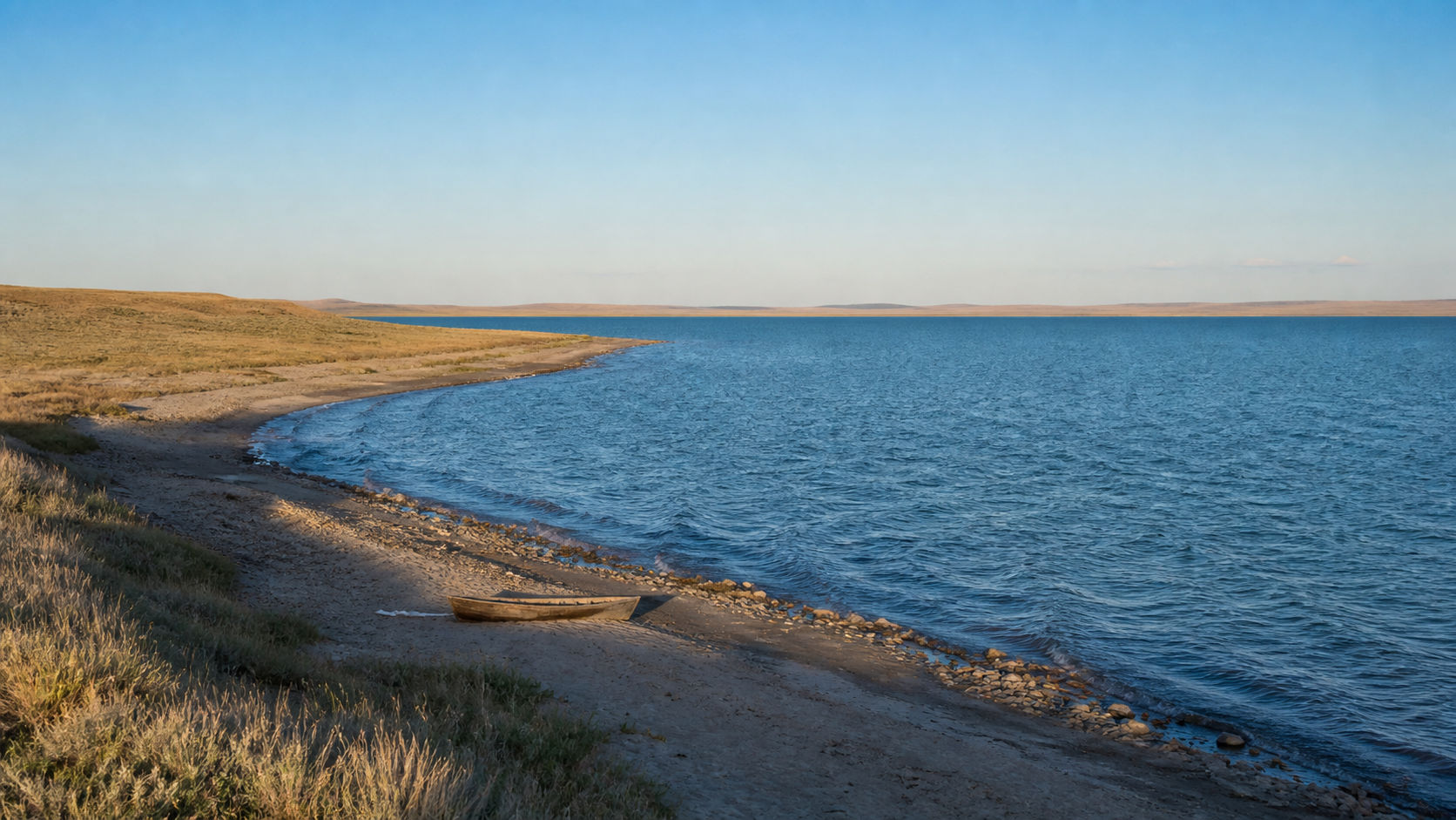
nature
Lake Balkhash Travel Guide: Two Waters, One Lake
A source-checked Lake Balkhash guide: why west and east differ, Kazakhstan's 2026 water update, a realistic trip plan, and swimming and fishing boundaries.
Plan the Next Step
travel
Kazakhstan Tourist Attractions: Choose the Right First-Trip Route
Compare Kazakhstan tourist attractions by base and logistics: Almaty nature, Turkestan heritage, Mangystau, Astana, Baikonur, and more.
food
Beshbarmak Recipe: How Kazakh Et Is Served
A source-checked guide to Kazakh et, widely called beshbarmak: what is on the platter, a practical home recipe, regional differences, and guest etiquette.
culture
Women in Kazakhstan: Rights, Work and Daily Life in 2026
Source-checked guide to women in Kazakhstan: current legal rights, dated work and wage data, marriage statistics, safety, and respectful language.
nature
Lake Balkhash Travel Guide: Two Waters, One Lake
A source-checked Lake Balkhash guide: why west and east differ, Kazakhstan's 2026 water update, a realistic trip plan, and swimming and fishing boundaries.
nature
Mangystau, Kazakhstan: Routes, Seasons and Trip Costs
Plan a Mangystau expedition from Aktau with current route, season, operator, sacred-site, safety and quote-check guidance for 2026.
nature
Kazakh Steppe: Landscape, Wildlife and How to Visit
Source-checked guide to the Kazakh steppe: its extent, Saryarka, Korgalzhyn, 2025 saiga data, seasons, and responsible access.

Travel Writer & Local Expert · Almaty, Kazakhstan
Tugelbay Konabayev is a Kazakhstan-based travel writer who has lived in Almaty for 7+ years and Astana for 4+ years. He grew up in Aktobe, Kazakhstan and has covered Kazakh travel, food, culture, and visa policy with first-hand reporting since 2023.