Kazakhstan Rivers: Irtysh, Ural, Syr Darya & Water Systems
Reported from the ground: Tugelbay Konabayev is a Kazakh native (born in Aktobe) who has lived 7 years in Almaty and 4 in Astana. About the author.
In this article10 sections
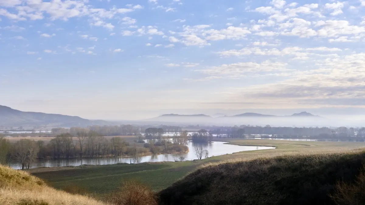
Kazakhstan’s rivers are among the most important water resources in Central Asia, shaping the country’s geography, economy, and environmental challenges. According to Britannica’s geography entry for Kazakhstan, the country’s east and southeast possess extensive watercourses, with most of the country’s 7,000 streams forming part of inland drainage systems. The seven longest rivers all exceed 1,000 kilometers in length: the Irtysh (Ertis), Ural (Zhaiyk), Syr Darya, Ili, Ishim (Esil), Tobol, and Chu. These waterways support agriculture, hydropower, drinking water supplies, and fisheries across Kazakhstan and neighboring countries. Yet the story of these rivers is also one of ecological stress - particularly the Aral Sea crisis, where Soviet-era irrigation projects diverted the Syr Darya and Amu Darya so severely that one of the world’s largest lakes collapsed, and lessons from that disaster now shape how Kazakhstan manages its remaining water resources. To understand the full scope of Kazakhstan’s geography, see our guide to Kazakhstan’s nature and mountain ranges.
| River | Kazakh Name | Length | Flows To |
|---|---|---|---|
| Irtysh | Ertis | 4,248 km total; 1,698-1,835 km in Kazakhstan | Ob River (Arctic Ocean) |
| Ural | Zhaiyk | 2,428 km | Caspian Sea |
| Syr Darya | Sырдария | 2,256 km total; ~1,400 km in Kazakhstan | Aral Sea (historically) |
| Ili | Іле | 1,400 km total; 815 km in Kazakhstan | Lake Balkhash |
| Ishim | Есіл | 1,400+ km | Irtysh River |
| Tobol | Тобыл | ~1,591 km | Irtysh River |
| Chu | Чу | ~1,186 km | Lake Issyk-Kul (Kyrgyzstan) |
The Irtysh River: Kazakhstan’s Lifeline to the Arctic
The Irtysh (Kazakh: Ertis) is the longest river flowing through Kazakhstan and the principal tributary of the Ob River, which drains to the Arctic Ocean. According to Britannica’s article on the Irtysh River, the Irtysh is 2,640 miles (4,248 kilometers) long overall, making it one of Asia’s longest rivers. Within Kazakhstan, the Irtysh flows for approximately 1,698 to 1,835 kilometers, depending on the measurement source. The river originates in the Mongolian Altai region and flows northwest through China, then enters Kazakhstan near the border with Russia.
The Irtysh basin is crucial to Kazakhstan’s water security. According to a transboundary river assessment, the Irtysh River Basin contributes 30% of the total water runoff to Kazakhstan’s overall water availability - the highest rate among all the country’s river basins. This makes the Irtysh Kazakhstan’s most vital freshwater resource for irrigation, industrial use, and drinking water.
Key Cities and Economic Role
The Irtysh flows past several important Kazakh cities, including Öskemen (Ust-Kamenogorsk) in East Kazakhstan Region and Semey (Semipalatinsk). Historically, Semey was a major trade hub on the Silk Road, and the Irtysh was its lifeline for commerce and water. Today, the river continues to support agriculture in the semi-arid regions it passes through, as well as hydroelectric power generation. The river’s lower reaches, where it passes into Russia toward the Ob, are also important for navigation and industrial cooling.
The Ural River: Boundary Between Europe and Asia
The Ural River (Kazakh: Zhaiyk) is the third-longest river in Europe and marks the conventional continental boundary between Europe and Asia. According to Britannica’s entry on the Ural River, the Ural is 1,509 miles (2,428 kilometers) long and drains an area of 91,500 square miles (237,000 square kilometers). The river rises in the southern Ural Mountains in Russia and flows southward, entering Kazakhstan near Oral (Uralsk), then continuing southwest to discharge into the Caspian Sea.
The Ural’s delta is a wetland of international importance. According to Wikipedia’s article on the Ural River, the Ural River Delta and adjacent Caspian Sea coast are designated as a Ramsar Wetland (reference number 1856), recognized for their ecological significance and as a refuge for migratory birds and fish populations.
The Ural and Kazakhstan’s Caspian Fishing Industry
The Ural forms one of the richest freshwater delta ecosystems in Central Asia. Its fish populations have historically supported commercial and subsistence fisheries, though overfishing and pollution have reduced stocks in recent decades. The river’s water is also used for irrigation in the arid western regions of Kazakhstan, particularly around the Mangystau and Atyrau regions.
The Syr Darya: The Aral Sea Casualty
The Syr Darya (also transliterated as Syrdarya or Sir Darya) is Central Asia’s longest river and one of the region’s most tragic environmental stories. According to Wikipedia’s article on the Syr Darya, the river flows for 2,256 kilometers through Kyrgyzstan, Uzbekistan, and Kazakhstan before historically draining into the Aral Sea. In Kazakhstan alone, the Syr Darya contributes approximately 1,400 kilometers of its course.
The Syr Darya’s role in the Aral Sea disaster cannot be overstated. Beginning in the 1960s, the Soviet government initiated massive irrigation projects to divert the waters of the Syr Darya (and the Amu Darya) to grow cotton in the desert. As Britannica notes, “in the south, the waters of the once-mighty Syr Darya have, since the late 1970s, scarcely reached the Aral Sea at all.” According to the Wikipedia article on the Aral Sea, the water diverted from the Syr Darya is used to irrigate about two million hectares (5,000,000 acres) of farmland in the Ferghana Valley - one of the world’s largest irrigation projects by area.
The Aral Sea Collapse
The consequences were catastrophic. The Aral Sea Wikipedia entry documents that the sea was formerly the third-largest lake in the world with an area of 68,000 square kilometers in 1960. By 2007, it had declined to just 10% of its original size, splitting into four separate lakes. The United Nations has called this “one of the planet’s worst environmental disasters”. The region’s once-prosperous fishing industry was devastated, local ecosystems collapsed, and the public health crisis continues to affect the Aral Sea region to this day.
Partial Recovery of the North Aral Sea
Kazakhstan has made efforts to partially restore the North Aral Sea. In 2005, the Dike Kokaral dam was completed to separate the shrinking North and South Aral basins. According to Wikipedia’s Aral Sea article, by 2008, the water level had risen 12 meters above 2003 levels, and by 2013, salinity had dropped enough that fish were once again present in sufficient numbers for some limited fishing to resume. This represents a partial success story in water management, though the larger Aral Sea crisis remains unresolved.
The Ili River: Lake Balkhash’s Lifeline
The Ili River (Kazakh: Іле) is Kazakhstan’s second-longest river and the primary water source for Lake Balkhash, the country’s largest freshwater lake. According to Britannica’s article on the Ili River, the Ili is 870 miles (1,400 kilometers) long and drains a basin between the Tien Shan range to the south and the Borohoro Mountains to the north. The river originates in the mountains of Xinjiang, China, and flows westward into Kazakhstan, eventually discharging into Lake Balkhash. For more on this vital freshwater system, visit our detailed Lake Balkhash guide.
The Ili is also historically navigable, making it one of only three major navigable rivers in Kazakhstan (along with the Irtysh and Syr Darya). Its valley is notably wetter than much of Central Asia and supports significant agricultural and settled populations, particularly around the fertile plains near Almaty.
Smaller Rivers: The Ishim, Tobol, and Chu
Beyond the major rivers, Kazakhstan has several other important waterways that shape regional geography and water availability.
The Ishim River (Esil)
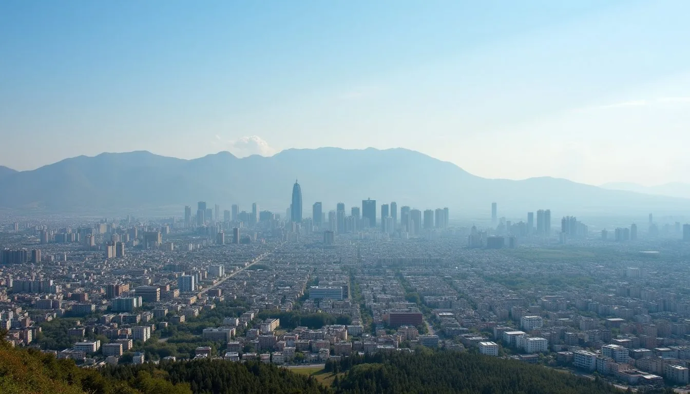
The Ishim (Kazakh: Есіл) is a 1,400+ kilometer river that flows through northern Kazakhstan and is famous as the river on which Astana, Kazakhstan’s capital city, is built. Though smaller than the Irtysh, the Ishim is crucial for the capital’s water supply and for agriculture in the central steppes.
The Tobol River
The Tobol (Kazakh: Тобыл) is approximately 1,591 kilometers long and flows through Russia and northern Kazakhstan as a tributary of the Irtysh. It drains much of the fertile northern plains region and joins the Irtysh in Russia.
The Chu River
The Chu (Kazakh: Чу) is roughly 1,186 kilometers long and flows through Kyrgyzstan and Kazakhstan before terminating in Lake Issyk-Kul in Kyrgyzstan (rather than reaching an ocean or sea). Despite not reaching the sea, the Chu is important for irrigating the agricultural regions of southern Kazakhstan it passes through.
Kazakhstan’s River Basins and Water Management
Kazakhstan’s water systems are divided into several major basins, each with distinct characteristics and challenges.
The Ob-Irtysh Basin dominates the north and east, providing the majority of Kazakhstan’s renewable water resources through the Irtysh River. This basin is relatively healthy compared to the others, as it is fed by snowmelt from the Altai Mountains and rainfall in the Russian highlands.
The Caspian Basin includes the Ural River and several smaller rivers that drain into the Caspian Sea. This basin is arid and water-stressed, with limited natural water resources.
The Aral-Syr Darya Basin encompasses the doomed Syr Darya and the Aral Sea. This basin suffers from severe water stress due to massive irrigation diversions and represents one of Central Asia’s most urgent water management challenges.
The Balkhash-Alakol Basin is fed primarily by the Ili River and smaller tributaries. Lake Balkhash itself is unique in that its eastern and western basins have different salinity levels, creating distinct ecological zones.
Hydropower and Water Infrastructure
Kazakhstan is investing heavily in hydroelectric power generation along its major rivers. Dams and hydropower stations on the Irtysh, Syr Darya, and Ili provide electricity to central Asia and support irrigation infrastructure. These projects, however, create environmental trade-offs: while they provide renewable energy and water storage for dry seasons, they also fragment river ecosystems and affect fish migration.
Environmental Challenges and Climate Change
Kazakhstan’s rivers face multiple stressors: agriculture-driven water diversion, pollution, dam construction, and now climate change.
Glacial melt from the Tian Shan and Altai mountains feeds most of Kazakhstan’s rivers. As glaciers shrink due to warming temperatures, the volume of water available during dry months is decreasing. The Syr Darya and Ili have already experienced reduced flow, putting pressure on irrigation systems that depend on predictable seasonal water supply.
Water pollution is another concern. Industrial runoff, agricultural chemicals, and urban sewage affect the quality of water in rivers like the Irtysh, particularly downstream of major cities. The Irtysh has historically been polluted by industrial facilities, and remediation efforts are ongoing.
Transboundary water management remains complex. The Irtysh is shared with Russia and China, the Ural with Russia, the Syr Darya with Kyrgyzstan and Uzbekistan, and the Ili with China. Disputes over water allocation and dam construction occur regularly, requiring negotiation and international cooperation.
Visiting Kazakhstan’s Rivers
While Kazakhstan’s rivers are not typically destinations for tourism in the way that mountain lakes or canyons are, they offer scenic and cultural experiences for those interested in water systems and Central Asian geography.
The Irtysh near Öskemen (Ust-Kamenogorsk) in East Kazakhstan offers river-based tourism, including boat tours and riverside walks. The city itself sits in a dramatic river valley surrounded by the Altai foothills.
The Ili River valley near Almaty is accessible for day trips, and the river’s wetlands support birdwatching and nature photography opportunities. Almaty, located on the edge of the Ili’s valley, is the primary base for accessing Kazakhstan’s water systems and mountain regions.
The Ural River delta, though remote, is accessible to adventurous travelers and birdwatchers interested in Central Asian wetlands.
The Aral Sea region, while economically devastated, has become an educational destination for those studying environmental management and ecological restoration. The North Aral Sea’s partial recovery project is a valuable case study in hydrology and environmental policy.
Sources Section
Primary References
- Britannica: Kazakhstan - Land and Drainage - Official geographical and hydrological overview of Kazakhstan’s rivers and water systems
- Britannica: Irtysh River - Detailed entry on the Irtysh, including length, basin, and geographic features
- Britannica: Ural River - Coverage of the Ural’s course, length, and ecological significance
- Britannica: Ili River - Information on the Ili’s geography, tributaries, and role in Lake Balkhash
Water Resources and Basins
- Wikipedia: Ural River - Comprehensive entry on the Ural River’s history, ecology, and importance to the Europe-Asia boundary
- Wikipedia: Syr Darya - Detailed article on the Syr Darya’s geography and role in Central Asian water systems
- Wikipedia: Aral Sea - Comprehensive documentation of the Aral Sea crisis, causes, and partial recovery efforts
- ScienceDirect: Transboundary River Assessment - Scholarly analysis of the Irtysh River Basin’s transboundary challenges and contribution to Kazakhstan’s water availability
Conservation and Environmental Context
- United Nations: Dry Tears of the Aral - UN perspective on the Aral Sea as an environmental disaster and its human impact
- Wikimedia Commons: Irtysh River Category - Photographs and maps of the Irtysh in Kazakhstan
Last verified: June 2026
Frequently Asked Questions
What are Kazakhstan's longest rivers?
Kazakhstan's seven longest rivers are the Irtysh (4,248 km total; ~1,835 km in Kazakhstan), Ural (2,428 km), Syr Darya (2,256 km total; ~1,400 km in Kazakhstan), Ili (1,400 km total; 815 km in Kazakhstan), Ishim (1,400+ km), Tobol (~1,591 km), and Chu (~1,186 km). The Irtysh is the longest river flowing through Kazakhstan and contributes 30% of the country's total renewable water resources.
Where does the Irtysh River flow?
The Irtysh (Ertis) originates in the Mongolian Altai region, flows through China and Kazakhstan, and continues into Russia where it merges with the Ob River. The Ob-Irtysh system flows northward to the Arctic Ocean. In Kazakhstan, the Irtysh passes through major cities like Öskemen (Ust-Kamenogorsk) and Semey (Semipalatinsk).
What is the Aral Sea crisis and what caused it?
The Aral Sea was the world's third-largest lake in 1960, covering 68,000 square kilometers. Beginning in the 1960s, the Soviet government diverted the Syr Darya and Amu Darya rivers for massive cotton irrigation projects in the Ferghana Valley. These diversions reduced water reaching the Aral Sea, causing it to shrink to 10% of its original size by 2007. The United Nations has called this 'one of the planet's worst environmental disasters,' destroying the fishing industry and creating public health crises.
Is the Aral Sea being restored?
Partially. Kazakhstan completed the Dike Kokaral dam in 2005 to separate and protect the North Aral Sea. By 2008, the North Aral's water level rose 12 meters, salinity dropped, and fish populations returned enough for limited commercial fishing. The larger South Aral Sea remains largely desiccated and has not recovered.
Which river supplies Lake Balkhash?
The Ili River is the primary water source for Lake Balkhash, Kazakhstan's largest freshwater lake. The Ili is 1,400 kilometers long and flows from the Tien Shan mountains in China westward into Kazakhstan, discharging into Lake Balkhash.
How does the Ural River relate to Europe and Asia?
The Ural River marks the conventional geographical boundary between Europe and Asia. At 2,428 kilometers long, it is the third-longest river in Europe. The river flows from the Ural Mountains in Russia southward through Kazakhstan, eventually discharging into the Caspian Sea near the city of Atyrau.
More Stories
travel
Cities in Kazakhstan: 90 Cities and Major City Guide
Cities in Kazakhstan ranked by size and travel value: Almaty, Astana, Shymkent, Karaganda and more, with May 2026 stat.gov.kz population data.

travel
Flights to Kazakhstan: Airlines, Routes & Prices
Complete guide to flights to Kazakhstan: airlines, direct routes, prices by season, budget tips, and airport transfers for Almaty and Astana.
travel
Kazakhstan Tourist Attractions: 18 Must-See Places
Kazakhstan tourist attractions: 18 must-see places from Charyn Canyon and Kolsai Lakes to Baikonur Cosmodrome. Entry fees, best seasons, and how to go.

travel
Kazakhstan Travel Tips: 25 Things to Know
Essential Kazakhstan travel tips for 2026 — visa, money, transport, SIM cards, culture, safety, food, and packing advice for first-time visitors.
Plan the Next Step
travel
Aktau, Kazakhstan: Caspian Sea City and Mangystau Gateway
Aktau travel guide covering the Caspian waterfront, Mangystau desert access, current ferry routing, flights, hotels, seasonal weather, and safety checks.
culture
Kazakhstan Religion: 2021 Census, Secular State & Visitor Context
Kazakhstan religion explained with the 2021 census: 69.3% Islam, 17.2% Christianity, a secular constitutional system and practical visitor guidance.
facts
Is Kazakhstan in Europe or Asia? The Clear Answer (2026)
Kazakhstan is classified in Central Asia by UN M49. The Europe–Asia boundary varies by convention, so this guide separates classification from geography.
travel
Astana, Kazakhstan: 15 Sights, Prices & 2-Day Itinerary
Astana Kazakhstan sightseeing guide: Baiterek Tower, Khan Shatyr, mosques, museums, prices, opening hours, transport, and a 2-day itinerary.
travel
eSIM Kazakhstan: Best Plans, Providers & Setup Guide (2026)
Complete guide to eSIM in Kazakhstan - Airalo, local providers, data plans, prices, coverage maps, and how to stay connected while traveling the country.
travel
Things to Do in Kazakhstan: 20 Places, Costs & Local Tips (2026)
Best things to do in Kazakhstan in 2026: Almaty mountains, Charyn Canyon, Astana sights, eagle hunting, trains, costs, locations, and local tips.

Travel Writer & Local Expert · Almaty, Kazakhstan
Tugelbay Konabayev is a Kazakhstan-based travel writer who has lived in Almaty for 7+ years and Astana for 4+ years. He grew up in Aktobe, Kazakhstan and has covered Kazakh travel, food, culture, and visa policy with first-hand reporting since 2023.