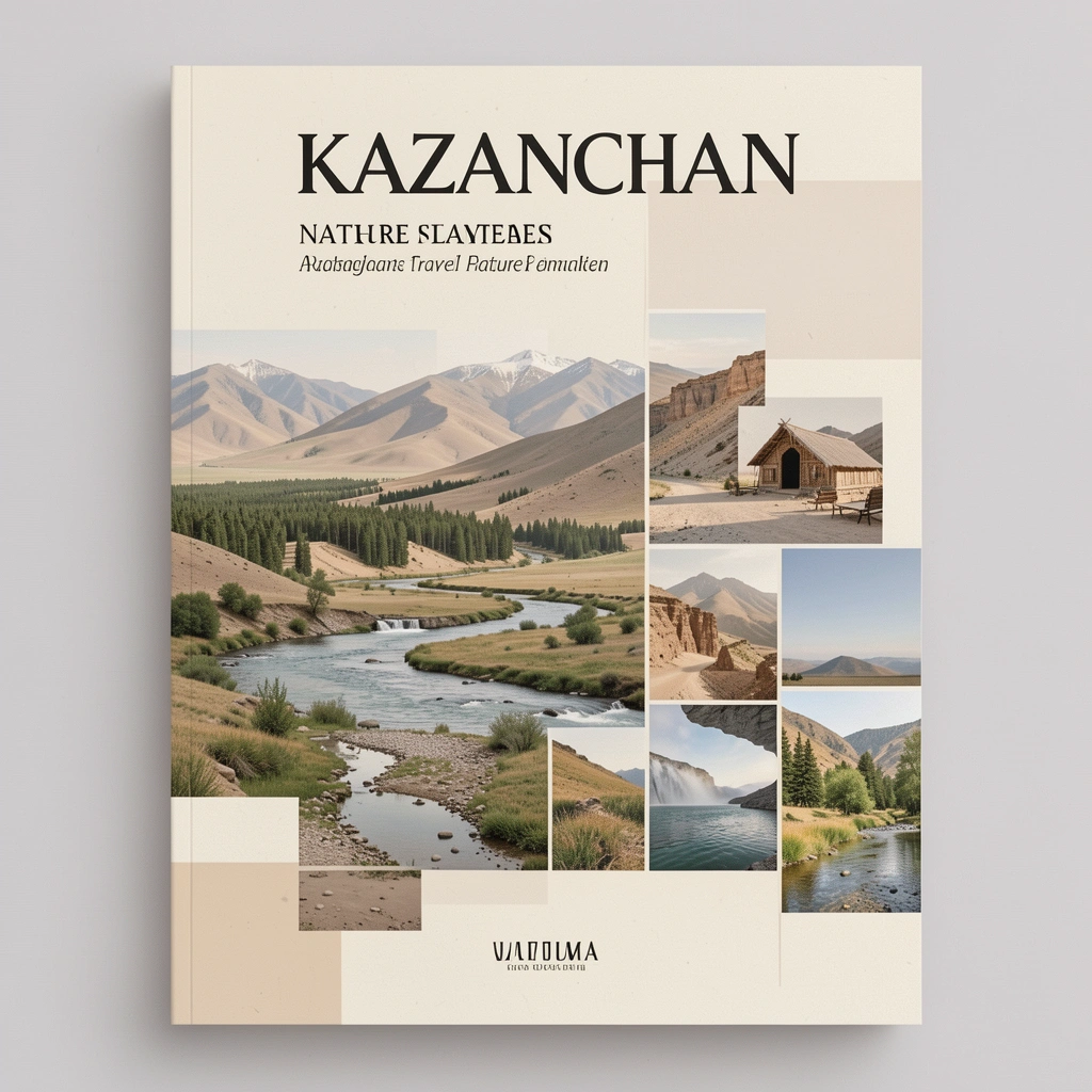
12 Best Hiking Trails in Kazakhstan: Difficulty & Costs
Reported from the ground: Tugelbay Konabayev is a Kazakh native (born in Aktobe) who has lived 7 years in Almaty and 4 in Astana. About the author .
Hiking in Kazakhstan is structured by progression: from beginner acclimatization walks (2-3 hours, zero elevation gain) to classic single-day summits (6-8 hours, 1.5 km gain), then serious multi-day alpine treks (3-7 days, 3,000-4,000 meter peaks and glacial valleys), finally to expedition-grade mountaineering (Khan Tengri base camp, 6,000+ m). The Tian Shan mountains rise directly behind Almaty, putting world-class trails 30 minutes from the city. The Kolsai and Kaindy lake system is a UNESCO Tentative Site. Kazakhstan covers 2.7 million square kilometers with over 50 marked trails across the Tian Shan, Altai, and Jungar Alatau ranges.
Trail access is free (national park entry $1-3), no permits required for recreational hiking, and the season runs May through October for lower elevations, June through September for alpine routes. You can hike for days without seeing another person.
Each level below builds on the previous: start with Kok-Zhailau to test fitness and altitude tolerance, graduate to Big Almaty Lake for sustained climbing, then Kolsai Lakes for your first nights in a tent. Skipping levels - attempting multi-day treks without day-hike experience, or Khan Tengri without rope skills - is the most common cause of evacuation.
Level 1: Acclimatization Walks (Beginner, Flat or Gentle Gain, 2-4 hours)
These walks are your entry point to altitude and mountain conditions without exposed terrain, scrambling, or water crossings. Most loop through alpine meadows and forests accessible by city bus, reaching 1,500-2,300 meters without technical risk. The main skills you build: pace management, hydration at altitude, reading weather, and recognizing fatigue signals before they matter. Completing any Level 1 walk qualifies you for a Level 2 day hike. Skipping this step and jumping to higher elevations causes altitude sickness and misjudged fitness.
1. Kok-Zhailau Meadow (Introduction to Altitude)
| Metric | Details |
|---|---|
| Distance | 11 km round trip |
| Elevation | 1,500 - 2,300 m |
| Difficulty | Easy, no scrambling |
| Duration | 3-4 hours |
| Trailhead | Medeu road (bus 12 from Almaty center, 30 min) |
| When | May-October (snow above 2,300 m Nov-Apr) |
| Payoff | Alpine meadow with 360-degree city views, wildflowers June-July |
The entry-level introduction to Almaty's Tian Shan. A wide path climbs through apple orchards and spruce forest to a 2,300 m meadow. Most hikers start here to acclimatize and gauge their altitude tolerance before committing to higher peaks. No technical skills, minimal stream crossings, and marked all the way. According to the IUCN Protected Planet database, the surrounding Ile-Alatau National Park covers 199,700 hectares directly above Almaty.
What you'll learn: Breathing technique at 2,300 m, pace management, hydration needs, and whether your knees tolerate sustained descent. Completing this walk in under 4 hours suggests you're ready for Furmanov Peak or Big Almaty Lake the following day.
2. Butakovka Waterfall (Shaded Forest Warmup)
| Metric | Details |
|---|---|
| Distance | 6 km round trip |
| Elevation | 1,400 - 1,700 m |
| Difficulty | Easy, minimal elevation gain |
| Duration | 2-3 hours |
| Trailhead | Butakovka village (taxi from Almaty $5, 20 min) |
| When | April-October (water flow heaviest spring/early summer) |
| Payoff | Shaded forest trail, 20-meter waterfall, zero crowds |
An alternative to Kok-Zhailau if you prefer shade and lower elevation. A gentle forest trail leads to a waterfall surrounded by spruce cover. Family-friendly, no scrambling, and you're back in Almaty in time for lunch. This is the walk to do on a rest day between harder efforts, or if you're recovering from travel fatigue and want to test your legs before committing to altitude.
Progression hint: Butakovka alone doesn't build real fitness. Pair it with a Level 2 hike to create useful adaptation.
Level 2: Day Summits (Intermediate, 1,000-1,500 m elevation gain, 5-8 hours)
These are full-day efforts with sustained climbing, exposed descent, and real altitude (2,500-3,000+ meters). You'll gain genuine cardiovascular fitness here and learn to manage fatigue across extended time. Route-finding becomes important as trails narrow and sections may be unmarked. Weather exposure is real, especially above 2,800 m where afternoon thunderstorms are common June-August. Completing a Level 2 hike qualifies you for your first multi-day trek (Level 3). The gap between Level 1 and Level 2 separates casual walkers from trekkers.
3. Big Almaty Lake Trail (First High-Altitude Day)
| Metric | Details |
|---|---|
| Distance | 14 km round trip |
| Elevation | 1,700 - 2,511 m (811 m gain) |
| Difficulty | Moderate, final section steep |
| Duration | 5-6 hours |
| Trailhead | Big Almaty Lake road gate (28 km from Almaty, 1 hour drive) |
| When | June-September (road usually closed Nov-Apr due to snow) |
| Payoff | Turquoise glacial alpine lake, mountain reflections, most accessible 2,500 m scenery in Central Asia |
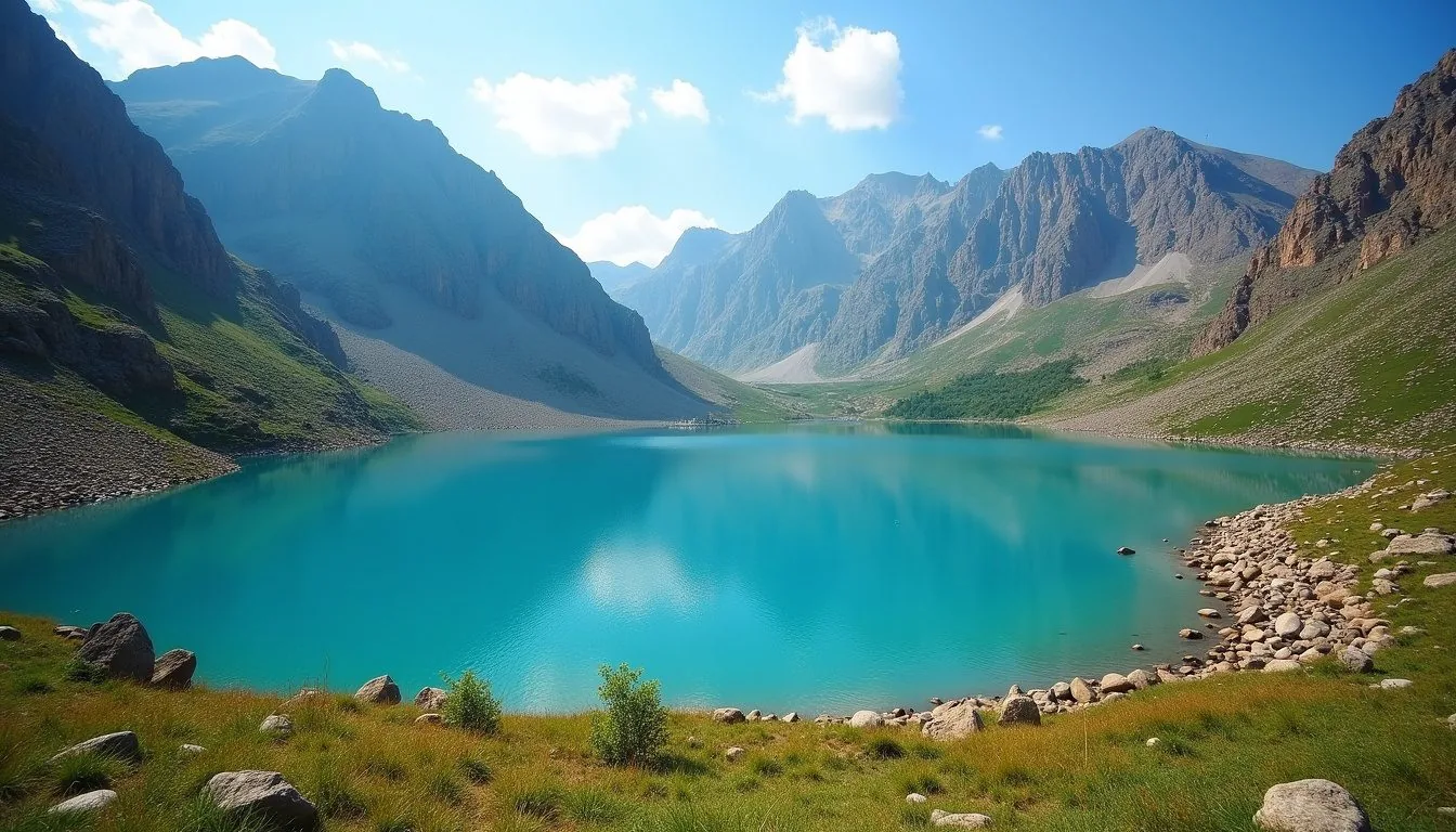
The benchmark Level 2 hike. The trail follows the unpaved road to Big Almaty Lake, a glacial lake that shifts between turquoise and emerald depending on light and season. The final 3 km is steep but straightforward. You'll spend 45 minutes on sustained climbing above 2,300 m, learning how your body handles thin air. The lake is photographed constantly for good reason: the turquoise color is real, and mountains surround you completely.
Why this is intermediate: The 811 m elevation gain is real work. The trail is obvious but steep descent stresses knees and calves. Altitude exposure starts to matter (headaches are common above 2,400 m for people moving fast). Completing this in 5-6 hours without altitude sickness or knee pain confirms you're ready for Furmanov Peak or a multi-day trek.
Linked experience: This trail pairs well with Medeu Skating Rink or Shymbulak Gondola on the same day, creating a full-mountain education.
4. Furmanov Peak (Summit Ambition)
| Metric | Details |
|---|---|
| Distance | 16 km round trip |
| Elevation | 1,500 - 3,053 m (1,553 m gain) |
| Difficulty | Moderate-Hard, final 300 m is scrambling |
| Duration | 6-8 hours |
| Trailhead | Kok-Zhailau junction (30 min from Almaty via bus 12 + hike to junction) |
| When | June-September (snow above 2,800 m Oct-May) |
| Payoff | 3,053 m summit, 360-degree panorama, first real mountain achievement |
A proper mountain summit without requiring rope or technical climbing. The last 300 meters involve scrambling over loose rock, which teaches foot placement and builds confidence on exposed terrain. The panoramic view from the top is unobstructed and includes peaks across the entire Almaty region. This is where most trekkers feel they've achieved something.
Progression signal: If Furmanov exhausts you (if you arrive at the summit with less than 1.5 hours of daylight remaining, or if you're too fatigued to descend carefully), you're not yet ready for multi-day treks. Do Big Almaty Lake again. If Furmanov feels manageable with energy to spare, Level 3 is achievable.
Route discipline: Start at 6-7 AM. Afternoon clouds (common after 2 PM in July-August) reduce visibility and increase lightning risk. Descent is longer than ascent; never summit less than 3 hours before dark.
Level 3: Multi-Day Alpine Treks (Advanced, 2-7 days, 2,000+ meter passes, camping required)
These treks introduce real wilderness logistics: water sourcing, camp selection, bear awareness, glacier hazard recognition, and self-rescue skills matter now. You'll spend 4-8 hours daily hiking while managing pack weight, campsite comfort, and fatigue accumulation. Navigation becomes critical; trails narrow and sections go unmarked. Altitude sickness risk increases with sustained time above 3,000 m. Most people should hire a guide for their first multi-day trek to learn decision-making and emergency protocols without the learning curve.
Completing a Level 3 trek qualifies you for Level 4 (serious backcountry routes). These treks are where the real Kazakhstan reveals itself: days of solitude, ecosystems shifting by elevation, and weather patterns you navigate rather than escape.
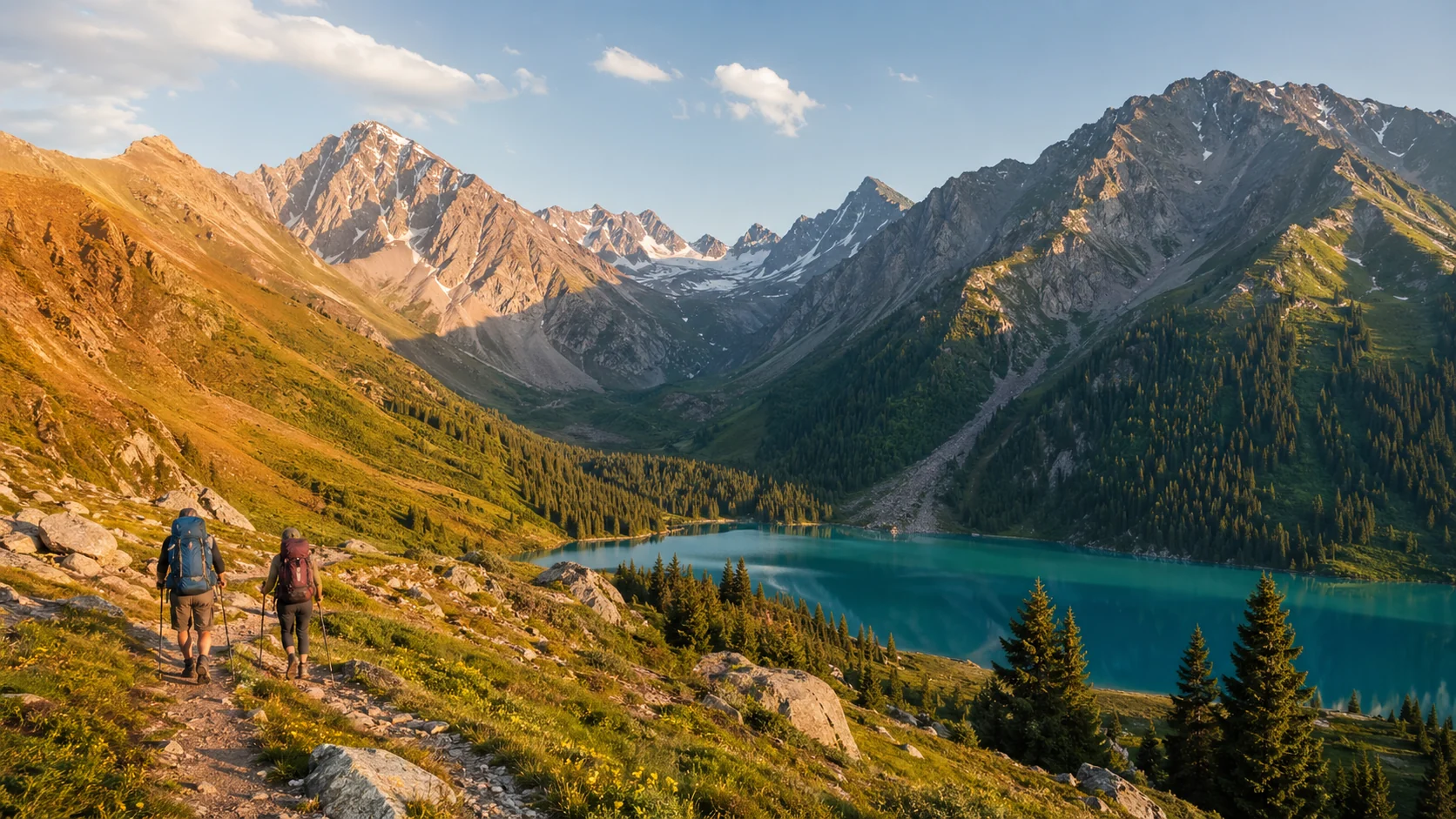
5. Kolsai Lakes Trek (Gateway Multi-Day)
| Metric | Details |
|---|---|
| Distance | 30 km total, split over 2-3 days |
| Elevation | 1,818 - 2,700 m, no single pass >500 m |
| Difficulty | Moderate multi-day, low technical risk |
| Duration | 2-3 days (2-3 nights camping) |
| Base | Saty village (330 km from Almaty, 5-6 hour drive) |
| When | June-September (roads passable, trails clear) |
| Camping | Wild camping allowed, designated sites at Lake 1 |
| Payoff | Three alpine lakes at stacked elevations, UNESCO Tentative Site status |
The entry-level multi-day trek and most popular choice for first-time backpackers in Kazakhstan. Three alpine lakes ascending in elevation: Kolsai 1 (1,818 m) surrounded by pine forest with guesthouses, Kolsai 2 (2,252 m) significantly more dramatic and rarely crowded, and Kolsai 3 (2,650 m) requiring serious alpine navigation. UNESCO added Kolsai Lakes to its World Heritage Tentative List in 2022.
Typical itinerary: Day 1, drive to Saty and hike to Lake 1, camp (3-4 hours). Day 2, push to Lake 2, camp (4-5 hours climbing). Day 3 (optional), Lake 3 requires crossing a ridge at 2,700+ m and a 700 m scramble. Each lake is a different shade of turquoise depending on glacial mineral load and light angle.
Why this is "gateway": Daily climbs don't exceed 600 m (manageable for someone who's done Furmanov), trails are marked most of the way, campsites are designated, and you can bail down to Lake 1 guesthouses if weather turns bad. But you'll sleep at altitude, manage a camp kitchen, and learn that hiking day 2 with tired legs is different from a single long day.
Gear requirements: Tent, sleeping bag (rated to -5°C minimum for June-July), stove + fuel, water filter or purification tablets, headlamp, trekking poles. Most renters in Almaty offer 2-3 day packages all-inclusive ($100-200/day including guide and meals).
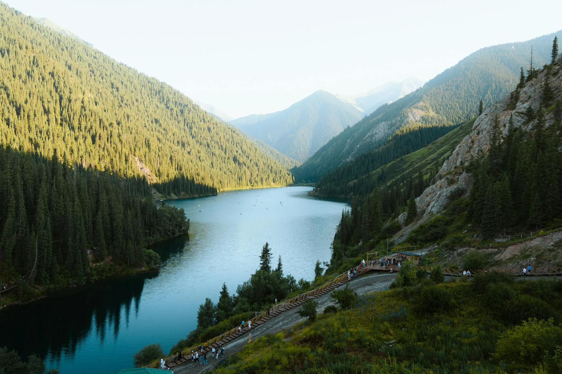
6. Turgen Gorge + Kaindy Lake (Waterfalls + Flooded Forest)
| Metric | Details |
|---|---|
| Distance | 25 km total over 2 days |
| Elevation | 1,400 - 2,000 m (500 m gain day 1) |
| Difficulty | Moderate, water crossings |
| Duration | 2 days (1-2 nights) |
| Base | Turgen village (90 km from Almaty, 2 hours) |
| When | June-September (river swollen May-June; lowest in Aug-Sep) |
| Payoff | 7 waterfalls including 30-meter Bear Falls, sunken spruce trees in turquoise water |
The route follows the Turgen River through a narrow gorge past seven waterfalls, then climbs to Kaindy Lake where dead spruce trunks rise vertically from the water - one of the most surreal alpine scenes in Central Asia. The highlight is the Bear Waterfall (30 meters), where the river drops in a single sheet. Water crossings are necessary; river levels vary dramatically by season (high May-early July when snowmelt peaks, manageable August-September).
Why this is useful: Shorter than Kolsai (only 2 days), easier logistically (closer to Almaty), but teaches water hazard awareness. The aesthetic payoff - flooded forest + waterfall gorge - is extraordinary. Many hikers combine this with a day trip back to Almaty or loop to a Kazakhstan rivers section for longer itineraries.
Timing constraint: Morning river crossings are safest (lowest flow). Never cross in afternoon when upstream snowmelt peaks. Plan to reach Kaindy by mid-afternoon on day 1 to avoid camping in gorge where escape options are limited.
7. Aksai Gorge to Ozerniy Pass (Serious Mountain Trekking)
| Metric | Details |
|---|---|
| Distance | 40 km over 3-4 days |
| Elevation | 1,500 - 3,300 m (1,800 m+ gain) |
| Difficulty | Hard, glacier exposure, unmarked sections |
| Duration | 3-4 days (3-4 nights camping) |
| Trailhead | Aksai village west of Almaty (2 hours by car) |
| When | July-August only (snow persists above 3,000 m through June) |
| Permit | Border zone permit needed (free, apply 10 days in advance at local migration police office) |
| Payoff | Glacial lakes, alpine tundra, 3,300 m pass crossings, genuine solitude |
A serious mountain trek crossing a 3,300 m pass between two Almaty valleys. You'll encounter glacial rivers (cross in morning when flow is lowest), navigate sections with no marked trail, and camp above tree line. Snow is possible at the pass even in August. This is where mountaineering skills begin to matter: rope rescue knowledge, glacier travel understanding, and acute altitude sickness recognition become relevant.
Why skipping earlier levels here is dangerous: Aksai is not a walk with altitude. It's technical mountain navigation. People attempting this after only city-based exercise or a single day hike commonly get evacuated due to altitude sickness, twisted ankles on unmarked terrain, or stream crossing accidents.
Guide requirement: Strongly recommended for your first attempt. Local guides cost $40-80/day and are worth it for route-finding and emergency decision-making.
Level 4: Serious Backcountry (7+ days, 3,500+ m peaks, no marked trails, minimal rescue infrastructure)
These routes require GPS navigation, full mountaineering gear, wilderness first aid training, and ideally previous expeditions at this level. Most people hire a guide even with considerable experience. Rescue response can take 24-48 hours; you need to be capable of self-evacuation.
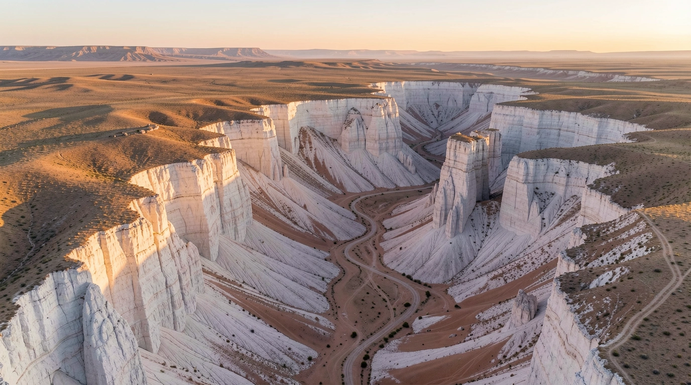
8. Charyn Canyon Valley of Castles (Day or Overnight Desert Hike)
| Metric | Details |
|---|---|
| Distance | 5 km loop canyon floor |
| Elevation | 900 - 1,000 m |
| Difficulty | Easy, minimal gain but sand/scree footing |
| Duration | 2-3 hours walking |
| Base | 195 km east of Almaty (2.5-3 hour drive) |
| When | April-October (December-March road closed by snow) |
| Payoff | 150-meter red and orange sandstone walls, photographically famous formations |
The most photogenic desert hike in Kazakhstan; red sandstone formations glow intensely at sunrise and sunset. The 80 km canyon was carved by the Charyn River over 12 million years and stretches through the steppe southeast of Almaty. The most visited section is the Valley of Castles, where 2 km of formations resemble medieval towers. A second zone protects the Sogdian Ash Tree Grove, an Ice Age remnant tree species with only one other grove on Earth.
Why it's Level 3 equivalent: The walk itself is easy, but the drive is substantial (5+ hours round-trip). Most hikers base a full day here: drive early morning, hike, return in evening. The payoff is aesthetic rather than physical. Unlike alpine routes, weather risk is heat (40°C+ in July-August), not storms. Water is scarce; carry 3+ liters.
Alternative: Overnight yurt camping at the canyon floor allows hiking at sunrise (best light) and sunset without rushing back.
9. Altyn-Emel Singing Dune (Desert Learning, Thermal Challenge)
| Metric | Details |
|---|---|
| Distance | 8 km round trip on flat desert |
| Elevation | 600 - 750 m (150 m gain), desert plateau |
| Difficulty | Easy terrain, serious heat management |
| Duration | 3-4 hours |
| Base | Altyn-Emel National Park (250 km from Almaty, 3.5-4 hours) |
| When | April-May, September-October (July-Aug exceed 40°C) |
| Payoff | 150-meter singing dune (acoustic phenomenon), Aktau Mountains resemble Mars |
Walk across flat desert to the base of a 150-meter crescent dune that produces a low humming sound when wind moves across its surface or when you climb it. Altyn-Emel National Park covers 4,600 km² and contains the Aktau Mountains (layered sedimentary formations in impossible colors - reds, oranges, golds - resembling a Martian landscape).
Why this teaches desert hiking fundamentals: Water consumption is extreme (3+ liters per person for a 4-hour walk). Heat kills faster than altitude; sunburn happens in 90 minutes. You learn to start at dawn, move steadily, and recognize heat exhaustion signals in yourself and partners.
Expedition consideration: This is where many first-time desert hikers realize they hate desert hiking. If Altyn-Emel is miserable, the Mangystau region (3-day desert expedition) is guaranteed misery. If you enjoy it, you're ready for serious desert work.
10. Burabay National Park (If Astana-Based, Easy Multi-Day Option)
| Metric | Details |
|---|---|
| Distance | Variable, 3-15 km loops available |
| Elevation | 300 - 600 m, minimal gain |
| Difficulty | Easy-Moderate |
| Duration | 2-6 hours per loop |
| Location | 250 km north of Astana |
| When | June-September (summer), December-February (winter scenery) |
| Payoff | Pine forests, granite outcrops, clear lakes, stark landscape change |
Pine-covered granite hills with lakes in the flat steppe north of Astana. Multiple marked trails loop around Burabay Lake and Okzhetpes rock (a granite cliff overlooking the lake). This is the trekking option if you're based in Astana and can't justify a 18-hour round-trip to Almaty's Tian Shan. It teaches trail navigation without serious exposure or altitude.
Limitation: Burabay doesn't build real Alpine fitness. Use it as a recovery hike between harder efforts or a movement break during city time.
11. Altai Mountains (East Kazakhstan, 5-7 Day Expedition)
| Metric | Details |
|---|---|
| Distance | Variable (typically 40-60 km over 5-7 days) |
| Elevation | 1,500 - 3,500 m |
| Difficulty | Very Hard, backcountry navigation |
| Duration | 5-7 days minimum (most people spend 7-10) |
| Base | Ridder or Ust-Kamenogorsk (east Kazakhstan) |
| When | July-August only |
| Payoff | Remote wilderness trekking, zero crowds, glacial valleys, alpine tundra |
Genuine backcountry in Kazakhstan's section of the Altai range, shared with Russia. No marked trails, minimal infrastructure, and genuine solitude. Glacial valleys, pristine alpine tundra, and the satisfaction of navigating terrain few Westerners visit. This requires GPS navigation skills, full camping equipment, weather prediction ability, and ideally a local guide.
Expedition mind-set: You're responsible for water sourcing, camp selection, bear awareness, and self-rescue. Helicopter evacuation costs $2,000+. Most people hire guides ($40-80/day) for their first Altai expedition.
Preparation: If Aksai Gorge felt pushable, Altai is achievable. If you struggled with Aksai logistics, spend another year on Level 3 routes.
12. Khan Tengri Base Camp (Expedition-Grade Alpine Mountaineering)
| Metric | Details |
|---|---|
| Distance | 50 km approach trek |
| Elevation | 2,800 - 4,100 m (base camp at 4,100 m) |
| Difficulty | Very Hard, glacier travel, ice axes required |
| Duration | 5-7 days |
| Season | July-August only (weather windows 2-3 weeks total) |
| Cost | $1,500-3,000 (fully guided expedition from Almaty) |
| Payoff | Approach to Khan Tengri (6,995 m, Kazakhstan's highest peak on Kyrgyz border), Inylchek Glacier, true mountaineering environment |
The approach trek to the base of Khan Tengri, Kazakhstan's highest peak on the border with Kyrgyzstan. According to Britannica's entry on Khan Tengri, the name means "Lord of the Spirits" in Turkic. The peak is famous for its distinctive pyramidal shape and extreme weather - storms can materialize in 30 minutes, and wind gusts exceed 120 km/h regularly.
This is mountaineering, not hiking. You'll cross the Inylchek Glacier (second-longest glacier outside polar regions), use ice axes and crampons, and operate above 4,000 m where altitude sickness becomes life-threatening. Only attempt if you have: (1) summited peaks above 4,500 m, (2) trained with ice axe and rope, (3) understood acclimatization protocols.
Why guides are non-negotiable: Companies like Kan Tengri (based in Almaty) operate guided expeditions. They handle permits, weather forecasting, glacier rescue, and rotational camps. You're paying for lives saved.
Seasonal and Elevation Timing
| Elevation | Best Hiking Months | Conditions | Difficulty Multiplier |
|---|---|---|---|
| Below 2,000 m | May-October | Snow-free, wildflowers May-June, variable weather April-May | Standard |
| 2,000-3,000 m | June-September | Snow possible June, clearest July-August, afternoon thunderstorms common | +20% fatigue |
| Above 3,000 m | July-August only | Short window, snow/ice possible year-round, altitude sickness risk real | +50% fatigue |
| Desert (Charyn, Altyn-Emel) | March-May, Sep-Oct | Avoid 40°C+ summer heat, spring has fresh water flow, autumn has stable skies | Heat kills faster than altitude |
Best time to visit Kazakhstan for hiking is July-August, when all trails are accessible and weather is most stable. Average daytime temperatures at 2,500 meters reach 15-20°C in July, dropping to 5-10°C at night. Afternoon thunderstorms are common above 2,800 m from mid-July through August, so plan to reach passes and exposed ridges before noon. September offers golden larch forests and fewer hikers, but nights drop below freezing above 2,000 meters. May-June sees wildflowers but also lingering snow above 2,500 m.
Costs and Gear Requirements by Level
| Category | Level 1 (Day, under 2,500 m) | Level 2 (Full day, 2,500+ m) | Level 3 (Multi-day camp) | Level 4 (Serious backcountry) |
|---|---|---|---|---|
| National park entry | $1-2 | $1-2 | $2-3 | $3-5 + permits |
| Guesthouse/camp | $0 (day) | $0 (day) | $15-30/night | $30-50/night (outfitter base) |
| Guide (optional) | Not needed | Optional | Recommended $40-80/day | Required $60-100+/day |
| Transport from Almaty | $5-15 (shared) | $30-50 (private) | $50-80 (private) | $100-200 (private + logistics) |
| Gear rental | None | $0 (day pack) | $15-20/day (tent, bag, stove) | $30-40/day (technical gear) |
| Total cost per day | $6-17 | $31-52 | $100-200/day | $200-400/day |
A 3-day self-guided trek to Kolsai Lakes costs about $50-80 total (transport + park entry + food for 3 people sharing). Guided multi-day treks run $100-200 per day all-inclusive (guide, transport, meals, camping). Serious backcountry expeditions (Altai, Khan Tengri) cost $1,500-3,000+ all-inclusive for 5-7 days.
Gear requirements escalate by level:
- Level 1: Water bottle (2L), sun protection, rain jacket, comfortable shoes, offline maps.
- Level 2: Above + trekking poles, headlamp, basic first aid kit, emergency communication (charged phone).
- Level 3: Level 2 + tent, sleeping bag (rated -5°C), stove + fuel, water filter/purification tablets, emergency food (high-calorie), repair kit.
- Level 4: Level 3 + ice axe, crampons, rope, glacier-crossing harness, avalanche beacon, GPS unit, wilderness medical training.
Gear Shops and Rental in Almaty
Equipment rental near Medeu cable car station: Silk Way Adventure and Steppe and Sky rent tents, sleeping bags, and backpacks for $5-15/day. Most shops also sell camping gas canisters, freeze-dried meals, and detailed topographic maps of the Zailiysky Alatau range. For multi-day treks, rent a satellite communicator (InReach or SPOT, ~$5/day) for emergency communication backup.
Trekking poles: Strongly recommended for any trail above 2,500 meters. They reduce knee strain on long descents and improve stability on scree slopes. Most rental shops sell or rent them ($2-3/day).
Topographic maps: Download offline on Maps.me or OsmAnd before departure. Cell coverage drops to zero outside Almaty suburbs.
Safety Protocols by Level
Level 1 & 2 (Day hikes): Start by 6-7 AM. Carry rain gear regardless of forecast (afternoon thunderstorms materialize fast above 2,800 m). Tell someone your route and expected return time. Bring 2-3 liters of water. Download offline maps.
Level 3 (Multi-day camping): Register your route with the national park office. Carry a satellite communicator (InReach or SPOT, ~$200 purchase, $5-10/month service) for emergency communication. Never camp directly under steep slopes (rockfall and avalanche risk). River crossings are safest in early morning (snowmelt peaks afternoon). Ascend gradually; descend immediately if acute altitude sickness symptoms appear (severe headache, nausea, ataxia).
Level 4 (Serious backcountry): Satellite communicator is mandatory. Carry rope, emergency shelter, and comprehensive first aid kit including IV fluids for severe altitude sickness. Know your self-rescue capabilities; helicopter evacuation costs $2,000+. Never travel alone.
Altitude Sickness Recognition and Response
Acute Mountain Sickness (AMS) starts above 2,000 m but is manageable with gradual ascent and hydration. Symptoms: mild headache, nausea, fatigue (common above 2,500 m). Treatment: rest, descend 300-500 m, drink 1 liter water, consider ibuprofen.
High Altitude Cerebral Edema (HACE) is life-threatening and rare but possible above 3,500 m after rapid ascent. Symptoms: severe headache, ataxia (loss of balance), confusion, hallucinations. Treatment: descend immediately to 2,000 m or lower, seek medical care, oxygen if available. This is why guides matter on Level 4 routes.
Prevention is primarily gradual ascent: Sleep at elevation below your daytime max (e.g., if hiking to 3,200 m on day 1, sleep at 2,500 m). Hydrate continuously (3-4 liters/day at altitude). Avoid alcohol and sleeping pills. Acclimatize: spend 1-2 days at 2,500+ m before pushing higher.
Wildlife and Water Safety
Snow leopards and ibex: Present throughout the Zailiysky Alatau range. According to WWF Central Asia, the Zailiysky Alatau is one of the most ecologically significant mountain areas in the region. According to IUCN Red List data, the snow leopard (Panthera uncia) is classified as Vulnerable, with an estimated 4,000-6,500 individuals remaining globally across 12 countries. Encounters with tourists are extremely rare; snow leopards actively avoid humans.
Brown bears and wolves: Exist in the Tian Shan but tourist encounters are rare. Make noise (talk or use a bear bell) while hiking to avoid surprising them. Never approach a bear; back away slowly and make yourself look large.
Snakes: Present in desert areas (Charyn, Altyn-Emel) but not aggressive. Watch where you step and reach when collecting wood or gear.
Water sourcing: Mountain streams above 2,500 m are generally drinkable untreated due to limited human/livestock presence. Below 2,500 m, filter or chemically treat water; livestock grazing contaminates lower elevations. Always carry a water filter or purification tablets.
River crossings: Swell with snowmelt June-early July. Cross in early morning when flow is lowest. Use trekking poles for stability. Never cross in afternoon when meltwater peaks.
Insurance and Evacuation Reality
Choose travel insurance that explicitly covers trekking, mountain rescue, and emergency evacuation above 3,000 m before attempting remote or high-altitude routes. Rescue services are limited outside Almaty. The nearest mountain rescue station is at Medeu (for Kok-Zhailau and nearby routes). For remote treks in Altai, Khan Tengri, or Mangystau, helicopter evacuation can take 24-48 hours depending on weather and costs $2,000-5,000 out-of-pocket if uninsured.
Insurance priorities:
- Medical evacuation coverage (not just repatriation)
- Helicopter rescue (most critical for serious injury)
- High-altitude (above 4,000 m if attempting Khan Tengri)
- Multi-sport or mountain-specific plans recommended
- Read fine print: some policies exclude "mountaineering" above 4,000 m or require guide verification
If insurance is unaffordable, limit yourself to Level 2 day hikes (low rescue complexity) or hire guides for Level 3 multi-day treks (rescue coordination is their responsibility).
Frequently Asked Questions
Your First Week in Kazakhstan
Week 1 progression (complete in this order, don't skip levels):
- Day 1 (arrival): Medeu Skating Rink + dam walk. Acclimatize to Almaty altitude (760 m), move your legs, no commit.
- Day 2: Kok-Zhailau Meadow (3-4 hours, Level 1). Assess altitude tolerance. If no headache/nausea, you're ready for Day 3.
- Day 3: Big Almaty Lake (5-6 hours, Level 2). Real elevation gain, practice sustained climbing. If you finish with energy, Furmanov is next. If exhausted, rest Day 4.
- Day 4: Furmanov Peak (6-8 hours, Level 2) or rest day. If Furmanov felt manageable, you're Level 3 capable.
- Days 5-7: Kolsai Lakes 2-3 day trek (Level 3). Sleep at altitude, manage camp kitchen, hike with fatigue. This is where you discover if backpacking is your thing.
Why progression matters: Kolsai is unforgiving if attempted by someone with only city fitness. Big Almaty teaches you what sustained climbing feels like at 2,500 m. Kok-Zhailau tests altitude response. Skipping any step is how people get injured or evacuated.
Linked Experiences and Route Combinations
For broader Kazakhstan tourism beyond hiking, see Kazakhstan tourist attractions (which organizes by time-from-base and effort-payoff). For river valleys and gorge hiking beyond the Tian Shan, see Kazakhstan rivers (Turgen Gorge, Charyn Canyon river walks). For winter mountaineering or ski mountaineering on peaks, see Kazakhstan winter olympics (when competition is active). For broader mountain geography, see Kazakhstan mountains. For comprehensive city-based planning, see Almaty travel guide.
Last verified: June 2026
More Stories
nature
Kolsai Lakes: Hiking, Costs, and How to Get There (2026)
Kolsai Lakes travel guide: hiking routes to all three lakes, 2026 park fees, Saty village stays, Kaindy Lake, transport from Almaty, and practical tips.
nature
Mangystau, Kazakhstan: Mars-Like Cliffs, Tours & Costs (2026)
Mars-like white cliffs, underground mosques, 4x4 tours $50-200/day. Fly via Aktau. Local guide: routes, costs, best season for Mangystau Kazakhstan.
nature
Kazakhstan National Parks: 14 Parks With Maps
Kazakhstan national parks: all 14 parks mapped with entry fees, best seasons, wildlife, and trails. From Charyn Canyon to Altai forests — plan your visit.
nature
Kazakhstan Nature: 12 Stunning Landscapes You Must See
Explore Kazakhstan's nature from the Altai Mountains to the Caspian shore. National parks, lakes, canyons, steppes, and the best times to visit each region.
Plan the Next Step
travel
Almaty Travel Guide 2026: Things to Do, 3-Day Itinerary & Costs
Things to do in Almaty, Kazakhstan: 3-day itinerary, mountain sights, restaurants, hotels from $25, Charyn Canyon day trips, and local costs.
travel
Astana, Kazakhstan: 15 Sights, Prices & 2-Day Itinerary
Astana Kazakhstan sightseeing guide: Baiterek Tower, Khan Shatyr, mosques, museums, prices, opening hours, transport, and a 2-day itinerary.
facts
Kazakhstan Population 2026: 20.5M People, Ethnic Groups & Map
Kazakhstan population in 2026: 20.5 million people, ethnic groups, city rankings, growth rate, density, age structure, and UN projections to 2050.
nature
Mangystau, Kazakhstan: Mars-Like Cliffs, Tours & Costs (2026)
Mars-like white cliffs, underground mosques, 4x4 tours $50-200/day. Fly via Aktau. Local guide: routes, costs, best season for Mangystau Kazakhstan.
nature
Kazakh Steppe: Grassland, Wildlife & Nomadic Culture
The Kazakh steppe covers 800,000+ km², larger than France and Germany combined. History, wildlife, nomadic culture, and how to visit today.
travel
Best Time to Visit Kazakhstan: Month-by-Month Guide (2026)
When is the best time to visit Kazakhstan? Complete month-by-month breakdown with temperatures, rainfall, crowd levels, activities by season, and regional tips.

Travel Writer & Local Expert · Almaty, Kazakhstan
Tugelbay Konabayev is a Kazakhstan-based travel writer who has lived in Almaty for 7+ years and Astana for 4+ years. He grew up in Aktobe, Kazakhstan and has covered Kazakh travel, food, culture, and visa policy with first-hand reporting since 2023.